


GPS Waypoint Finder

توضیحات GPS Waypoint Finder
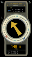
Uses the GPS sensor, Magnetic Field Sensor and Accelerometer to determine the distance and direction to a GPS waypoint. Does not need to be held level. Free & No Ads.
Normally a compass needs to be level to get the correct reading, but this app uses the accelerometer reading to convert the magnetic field reading back to the horizontal plane.
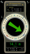
In addition to the direction and distance to the waypoint, a compass ring shows the current heading. North points to True North (i.e. The direction is corrected for the magnetic declination - the difference between magnetic north and true north).
The GPS reading and the time since that reading is shown at the bottom of the screen.
Use for geocaching, finding your car, hotel, or other locations.
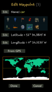
• Store up to 500 waypoints.
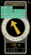
• Imperial or Metric units.
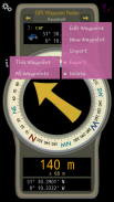
• Import and Export waypoints as GPX files.
Arrow colour changes to green at less than 30m and blue at less than 10m to make it easier for littler ones to identify that they've reached the waypoint.
Whilst walking, look where your going, not at the app or you might trip! The app tells you the direction of your destination, not how to get there.
Only as good as the sensors in your device. Use for Indication Only.
</div> <div jsname="WJz9Hc" style="display:none">Maakt gebruik van de GPS-sensor, magneetveldsensor en Accelerometer om de afstand en richting naar een GPS waypoint te bepalen. Hoeft niet te worden gehouden niveau. Gratis en geen advertenties.
Normaal moet een kompas niveau om de juiste waarde krijgen, maar dit app gebruikt de accelerometer lezing het magneetveld teruglezen van het horizontale vlak te zetten.
In aanvulling op de richting en afstand tot het waypoint, een kompas ring toont de huidige koers. North punten True North (dwz De richting wordt gecorrigeerd voor de magnetische declinatie - het verschil tussen het magnetische noorden en het ware noorden).
De GPS lezen en de tijd sinds deze lezing wordt getoond aan de onderkant van het scherm.
Gebruik voor geocaching, het vinden van uw auto, hotel of andere locaties.
• Bewaar maximaal 500 waypoints.
• Imperial of metrische eenheden.
• waypoints Import en Export als GPX-bestanden.
Arrow kleurveranderingen groen minder dan 30 m en blauwe minder dan 10 meter te vergemakkelijken voor littler te identificeren dat de waypoint heeft bereikt.
Terwijl het lopen, kijk waar je naartoe gaat, niet in de app of u misschien reis! De app vertelt je de richting van uw bestemming, niet hoe er te komen.
Maar zo goed als de sensoren in uw apparaat. Gebruik voor Indicatie Only.</div> <div class="show-more-end">


